| . |
. |
Electoral Commissions |
. |
. |
| . |
. |
| . |
. |
. |
. |
. |
. |
. |
. |
. |
. |
. |
. |
. |
. |
. |
. |
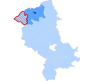
| Polska / mazowieckie, woj. / Siedlce / ostrołęcki, pow. / Czarnia, gm. |
 |
| Czarnia, gm. |
| No. of electoral constituency: |
17 |
| Teryt: |
141502 |
| Commune type: |
gmina wiejska |
| Statistics |
| Population: |
2873 |
| Area: |
92.53 km2 |
| Population density: |
31 os/km2 |
| Electoral Statistic |
| No. of people entitled to vote: |
2070 |
| Number of wards: |
4 |
| |
|
| |
|
|
rural commune |
 - location accessible for the handicapped - location accessible for the handicapped |
| |
| |
|
|
rural area in urban-rural commune |
| |
| |
|
|
urban area in urban-rural commune |
| |
| |
|
|
urban commune |
|
| . |
. |
Types of ward |
. |
. |
| . |
. |
| . |
. |
. |
. |
. |
. |
. |
| Type |
Number |
 |
| Powszechny | 4 | 1 |
| total |
4 |
1 |
|
|
|


 Legal Acts
 Documents
 Electoral Bodies
 Election Committees and Candidates
 Turnout
 Results
 Statistical Data
 SEJM
SEJM Created by
 Constituency Electoral Commissions
 Ward Electoral Commissions
 Legal Acts
 Documents
 Electoral Bodies
 Election Committees and Candidates
 Turnout
 Results
 Statistical Data
 SEJM
SEJM Created by

